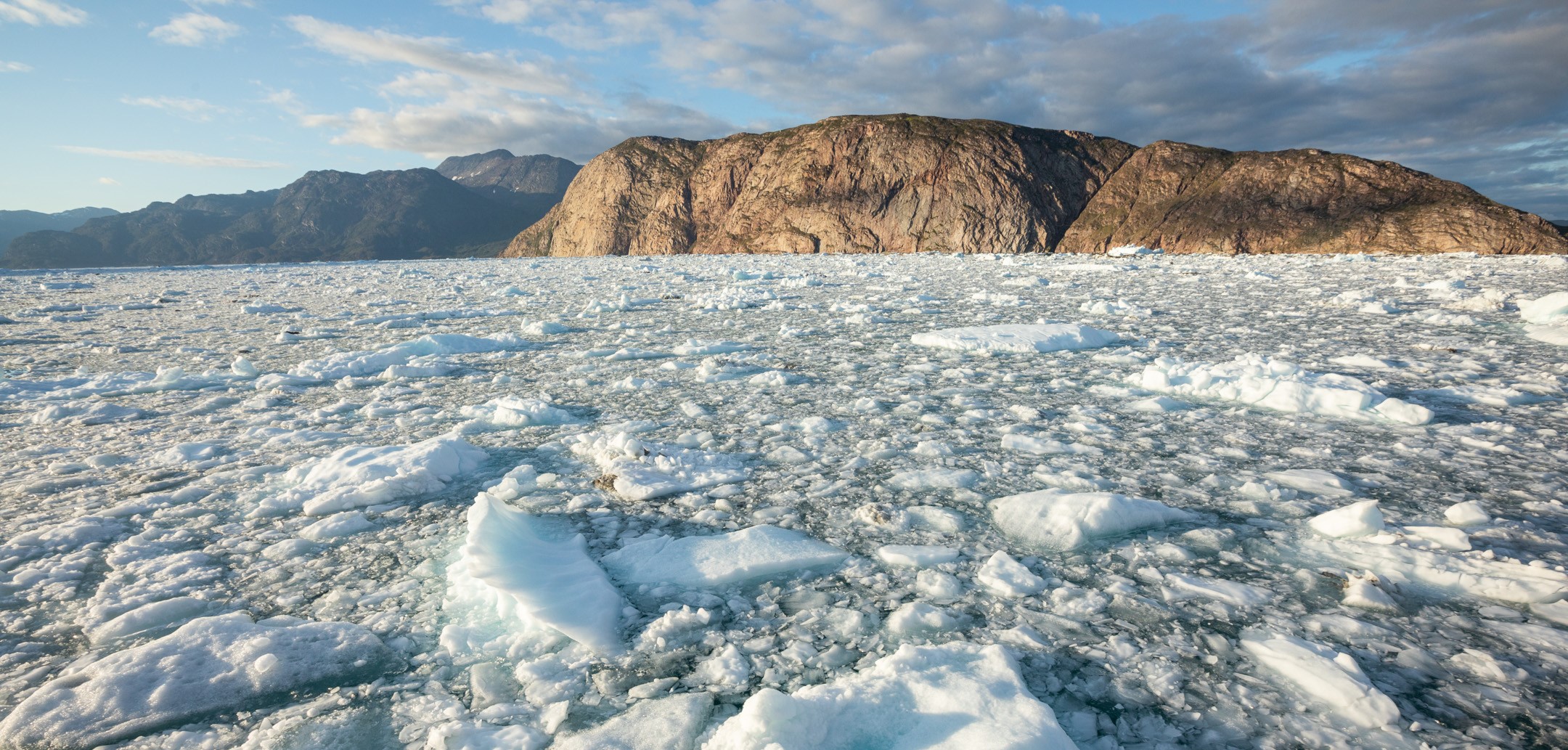

Rapid dynamic mass loss from ocean-terminating outlet glaciers is pivotal for the current and future evolution of the GIS and sea level and contributes substantial fluxes of freshwater, icebergs and sediments into coastal fjords. The ice-ocean boundary thereby plays a crucial role for both the evolution of the calving margin and the circulation of energy and nutrients within the fjord and hence the functioning of the fjord-ecosystem. The detailed interaction at this fjord-glacier boundary and the influence of environmental forcing, in particular of buoyancy driven plume upwelling from subglacial water discharge, and on iceberg calving and related fluxes are poorly understood and quantified. The major issues are logistical and physical difficulties in accessing and measuring this ice-ocean interface at sufficiently high temporal and spatial resolution. GreenFjord is therefore ideal to overcome these challenges with an interdisciplinary approach.
The Cryosphere cluster focusses on an ocean-terminating outlet glacier of the Greenland ice sheet (GIS) and aims to
(i) understand and constrain the process of iceberg calving and the influence of oceanic melt and related discharge driven meltwater plumes thereon,
(ii) apply and advance related emerging observational monitoring methods, and
(iii) quantify the related fluxes of freshwater, icebergs and sediments to the fjord system and assess their influence on fjord circulation.
During repeated multi-week field campaigns at calving glacier Qajuuttap Sermia in southwest Greenland, we combine emerging and established field-methods such as terrestrial radar interferometry (TRI), time-lapse imagery (TLI) and seismic sensing to continuously observe and quantify the processes and fluxes at the ice-ocean boundary.
The methods of TRI and TLI are used to continuously record surface ice flow, calving dynamics above the waterline as well as meltwater plume activity and iceberg motion in the adjacent fjord at meter and minute scales.
Pioneering seismic measurements are proposed in order to constrain processes below the water and ice surface. A fiberoptic cable in the proglacial fjord will record basal sliding and sustained hydraulic tremors reflecting turbulent subglacial plume discharge by distributed acoustic sensing (DAS). This approach will be complemented with three ocean bottom seismometers (OBS) with superior signal-to-noise ratios. Both approaches will also record marine mammal vocalizations such as whale songs, allowing inferences on species residence in the fjord. Finally, three on-land broadband seismometers (BBS) next to the terminus will record year-round multi-annual seismic signals related to calving events. The above sophisticated approaches will be combined with robust year-round continuous observations from time-lapse cameras, wave-gauges, automatic weather stations and ablation stakes at the ice margin in order to extrapolate the fluxes and activity of calving, ice flow and water at this ice-ocean boundary throughout the seasons. These observations will be complemented by synchronous hydrographic surveys in the fjords (Ocean cluster), repeated UAV-surveys and existing operative satellite products for ice flow (MEASUREs https://nsidc.org/data/measures/; ESA-Ice-Sheet-CCI https://cryoportal.enveo.at/) and ice fluxes. Based on the above data and using a high-resolution fjord model (MITgcm), fjord circulation and oceanic melt will be modeled. Ice-melt at higher elevations on the ice sheet will be constrained by the existing nearby automatic-weather-station Q-transect and ablation-wires from PROMICE (GEUS, https://promice.org/download-data/). Together with large scale operational regional climate model based products (PROMICE/GEUS https://promice.org/download-data/) these data will constrain freshwater discharge from both ocean- and land-terminating ice sheet margins. In addition, variations in stream discharge and sediment load from land-terminating margins will be monitored ice surface samples taken in collaboration with the Land- and Biodiversity-clusters.
The combination of these datasets will provide a unique base for understanding processes at the ice ocean boundary for validation of calving models. Ultimately, it will provide continuous estimates of circulation and fluxes of water, ice and sediment into and within the fjord which is essential for understanding the functioning of the fjord ecosystem.
Cluster Project Investigator
Prof. Dr Andreas Vieli, Glaciology and Geomorphodynamics Group, University of Zurich
Cluster Participants
Dr Ethan Welty, Glaciology and Geomorphodynamics Group, University of Zurich
Armin Dachauer, Glaciology and Geomorphodynamics Group,University of Zurich
Diego Wasser, Glaciology and Geomorphodynamics Group, University of Zurich
Dr Andrea Walter, Glaciology and Geomorphodynamics Group, University of Zurich
Dr Martin Lüthi, Glaciology and Geomorphodynamics Group, University of Zurich
Dr Sebastian Rosier, Glaciology and Geomorphodynamics Group, University of Zurich
Selina Wetter, University of Paris
Dr Fabian Walter, WSL, Birmensdorf
Dr Dominik Gräff, ETH Zurich
Dr Alec van Herwijnen, SLF, Davos
Dr Guillaume Jouvet, Glaciology and Geomorphodynamics Group, University of Zurich
Dr Brad Liposky, Environmental Geophysics and Computation Group, University of Washington, Seattle, USA
Prof. Dr Fiametta Straneo, SCRIPPS Institution of Oceanography, UCSanDiego, USA