Where glaciers and land meet: an interdisciplinary field campaign within the GreenFjord project – Armin Dachauer
An interdisciplinary field campaign with members from the land cluster and the cryosphere cluster of the GreenFjord-project took place in May/June 2023. We joined forces, shared know-how, equipment and the logistical workload that such an expedition entails with the aim to answer research questions for both clusters and in particular to investigate the processes connecting the land and the cryosphere, such as the erosion and export of land-derived organic matter and sediments by glacial meltwater.
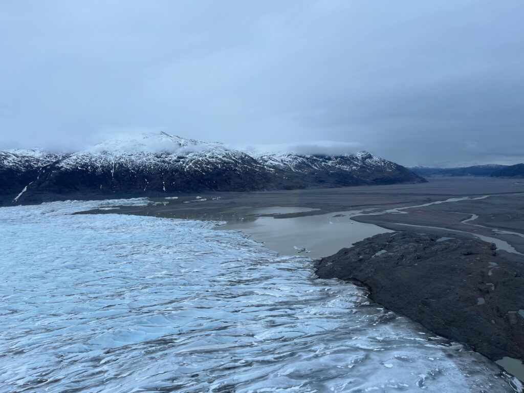
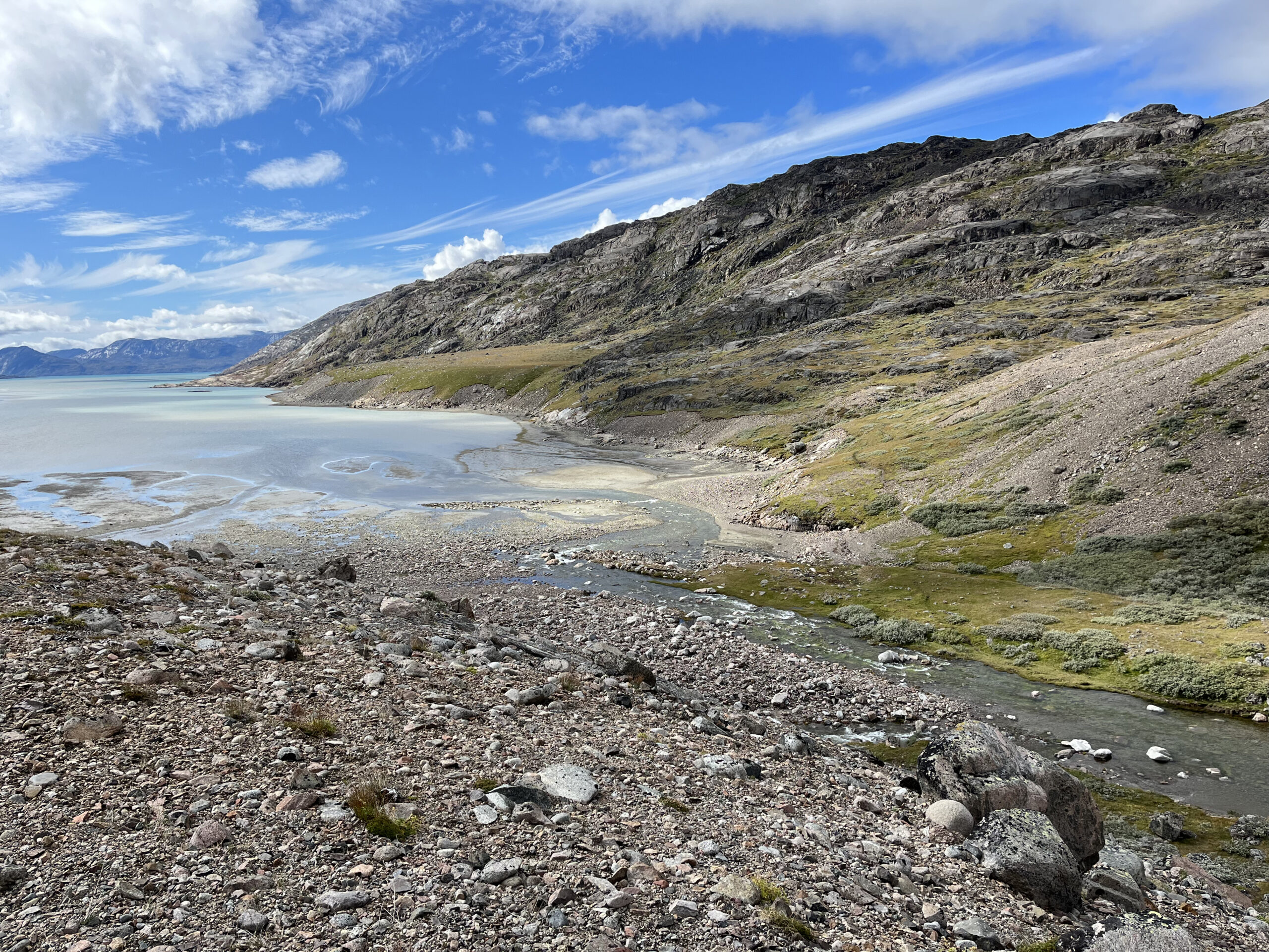
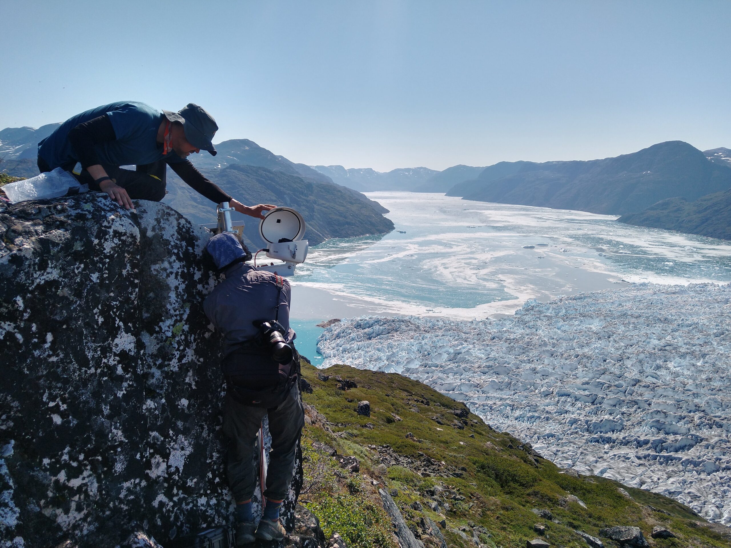
The field campaign took place at several sites of the fjord Igalikup Kangerlua, starting with the installation of ablation stakes and an ablatometer on the land-terminating glacier Jespersen Brae, to continuously monitor the ice melt throughout the next two years and sampling of the glacial outflow.
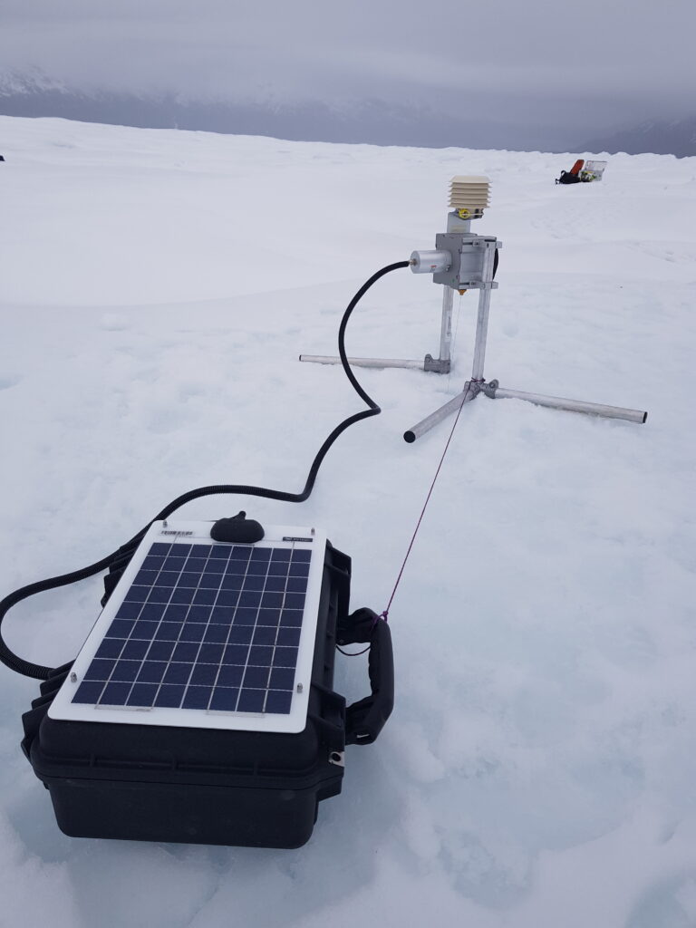
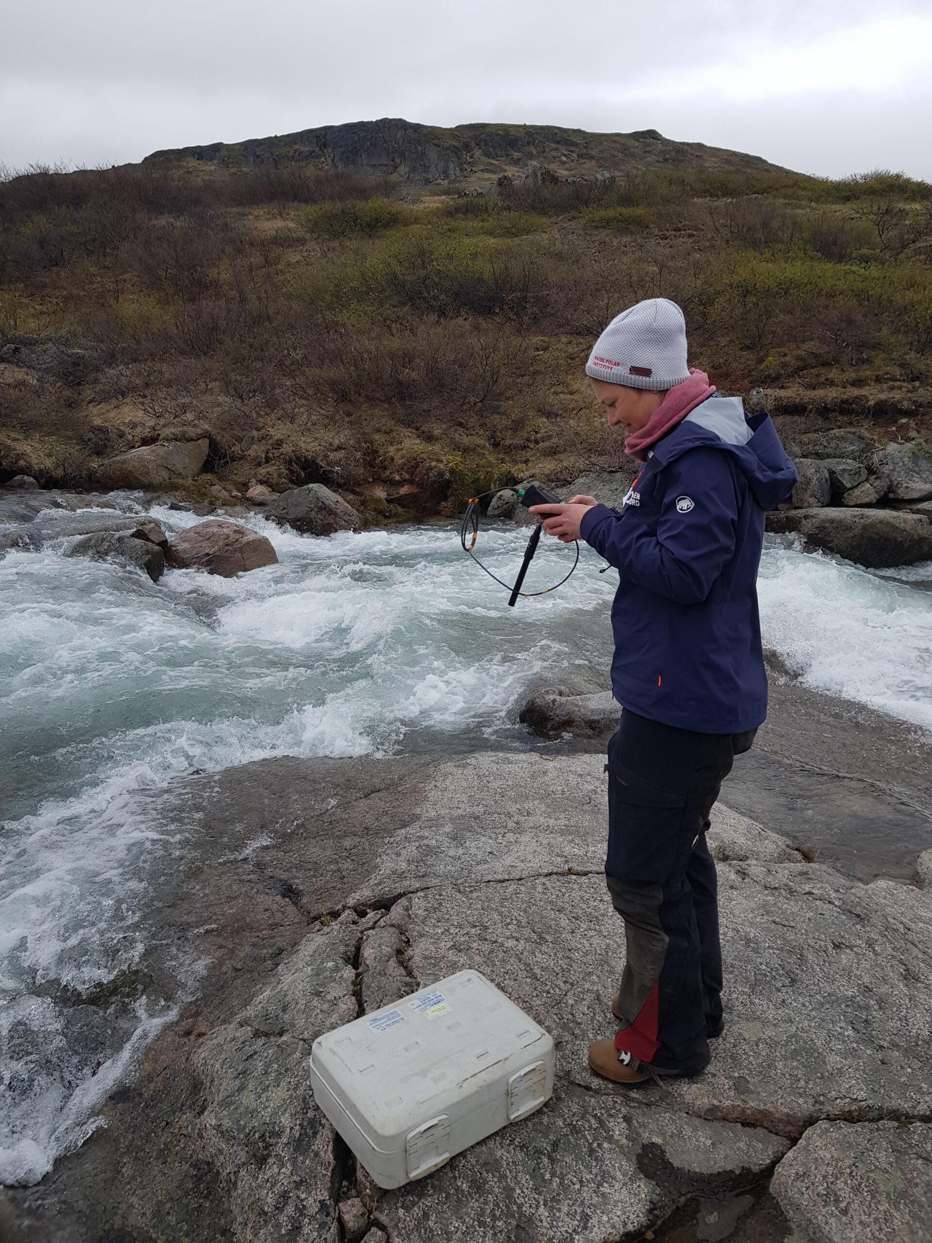
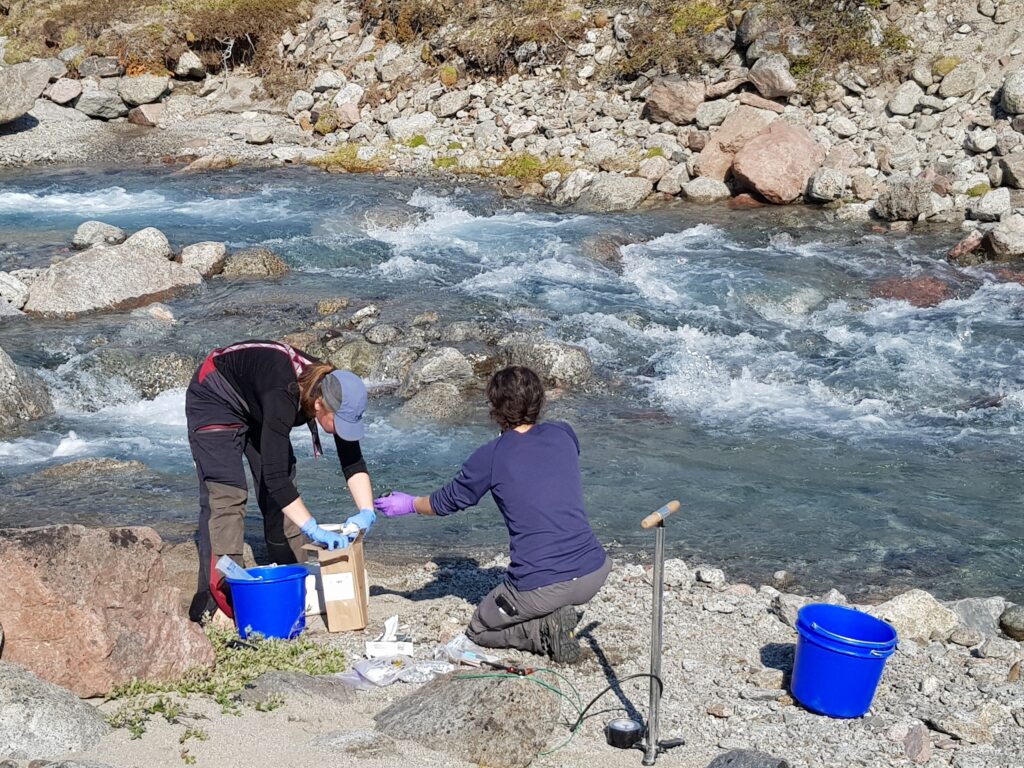
In the following days, sensors measuring water level, pH, dissolved oxygen and conductivity were installed further downstream in the glacier river and in a stream without glacial influence close to the town of Igaliku. At the glacial stream, additionally, a seismometer and a turbidity instrument were installed.
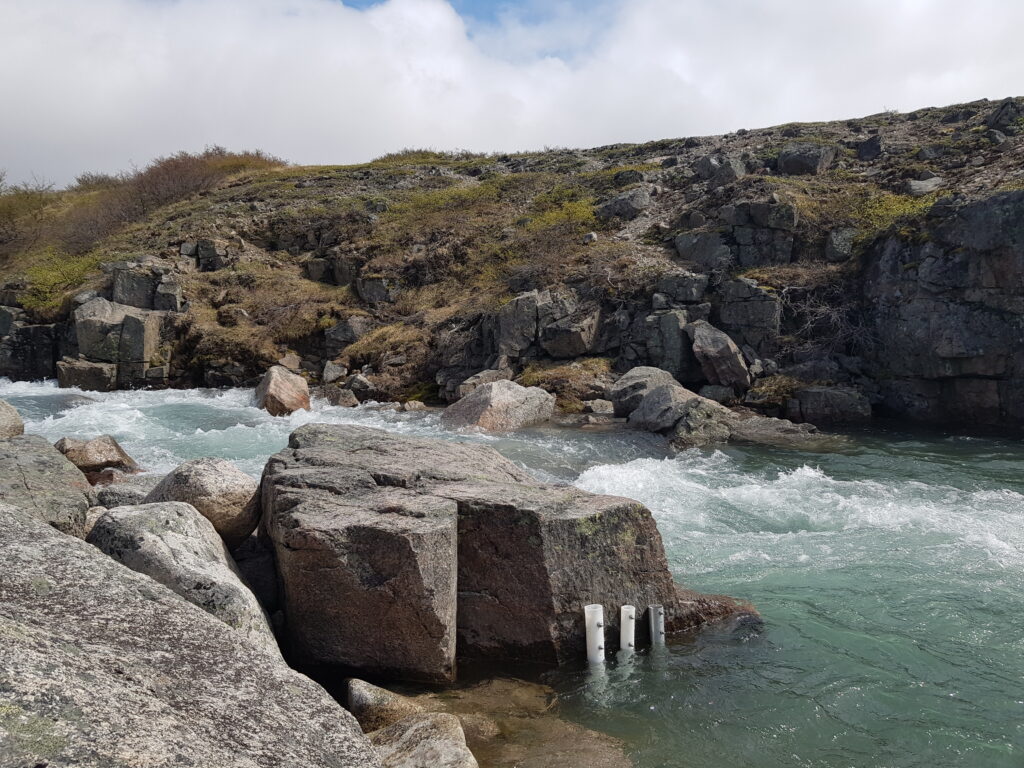
For all of these locations, we also collected water samples to determine the concentration and composition of the dissolved and particulate constituents, and to analyse for environmental DNA. The soil and sediment were also sampled in the vicinity of the streams for comparison. For both streams, water discharge was estimated using various tracing methods.

During the boat-transfer from one site (glacial river) to the other (the small town Igaliku), we further took several hydrographic profiles in the fjord and measured water temperature and salinity along water depth.
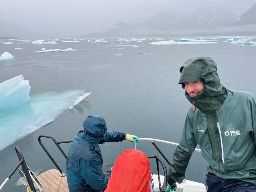
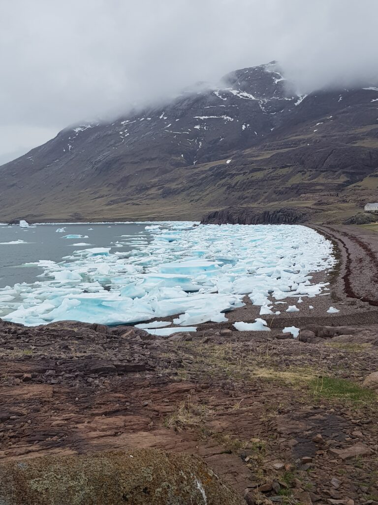
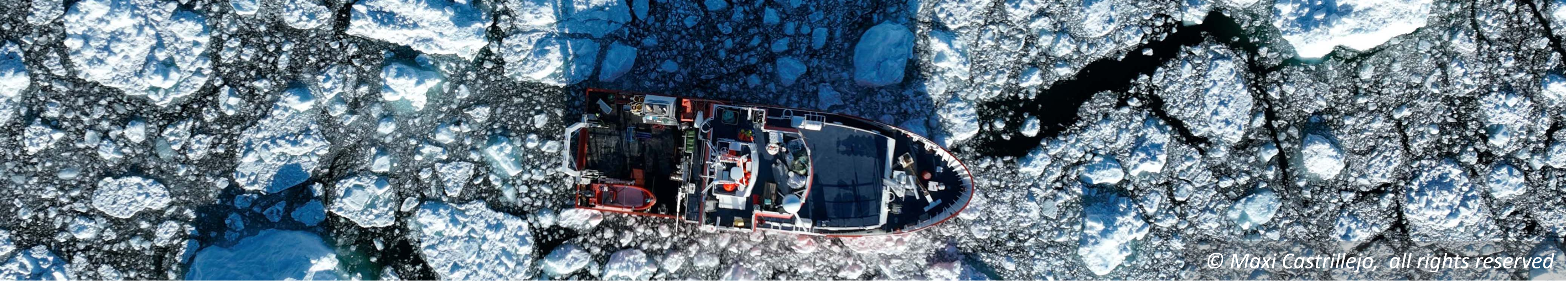
The team had a first-hand experience of how weather conditions directly impacted comfort, planning, and the overall feasibility of conducting fieldwork in Greenland. It started with an extra day in Copenhagen, as bad weather delayed the arrival in South Greenland. Then, rain, wind, and relatively cold temperatures were constant companions during the field trip. Additionally, the ice conditions within the fjord underwent a dramatic transformation during this period. The fjord suddenly became densely packed with sea ice that was transported by currents from East Greenland along the coast and pushed into the fjord by the wind. This significantly slowed down or even rendered boat rides impossible. Still, we managed to accomplish the major goals of this field campaign – but the experience served as a good reminder of the importance of careful planning and constant (re-)evaluation of the (weather) conditions, as well as of the flexibility and improvisation needed in the Arctic.